Mountains. For years, I've been wanting to see mountains (yes, "
mountains, Gandalf!") again, because we just don't have them in South Australia. The last time I saw a mountain with my own eyeballs was almost twenty years ago (Alaska, where else?) so ...
The Grampians lie in the far, far west of Victoria, which to us is a five hour drive
east. To give you some context here --
Climb into a decent car. Start where it says ADELAIDE and end where you see that orange balloon, which is pointing at a gorgeous little town called Halls Gap. That's where you're going, with a booking at the
fantastic Halls Gap Log Cabins.
The scale of the above map doesn't matter much, because how fast you can do the journey depends on so many factors (differing state speed limits, road construction, how fast
you feel comfortable driving, what your car will do without protest ... the number of humongous trucks on the road, how often
you need to stop and rest, if you're going cafe to cafe ... whatever). 'Nuff said if I tell you, it's five and a half hours if you don't stop at all, and closer to
seven and a half in reality, because if you don't stop, you'll probably drive right in front of one of the aforementioned gigantic trucks.
But the drive can be fun in its own way, and I'll tell the story of that in another post. For now, this is a look at the Grampians themselves ...
 |
| Lake Wartook |
 |
| One of numerous waterfalls at Mackenzie Falls |
And again, let me give you a bit of context here:
The whole Grampians area was created a national part only as recently as 1984, and it's a mercy that this was done because agriculture, logging, residential building ... it's all impacted enormously. It was only a matter of time before someone found something to mine there, and ...! Thank heavens, the national park status protects this, ostensibly forever.
The region itself is ancient. I'll save you zipping all over the Internet and paste in this segment direct from the
Victorian Tourism site:
Aboriginal people have had an association with the Grampians for more than 30,000 years. Traditionally known as Gariwerd, the land is at the center of creation stories for many of the Aboriginal communities in south-western Victoria. Discoveries of Indigenous Australian artifacts in the region include ancient oven mounds, scatterings of stone left over from tool making, and ancient rock art sites.
Six seasons
The traditional owners of Gariwerd recognize six distinct weather periods in the seasonal cycle, which relate to climactic as well as environmental events such as plant flowering, fruiting and the behavioural patterns of local wildlife. For millennia, the Jardwadjali and Djab Wurrung people have been linked to this seasonal cycle, which includes Gwangal Moronn (the season of the honey bee), Chinnup (the season of cockatoos) and Petyan (the season of butterflies).
The first thing someone like myself says, upon getting into the mountains is, "OMG, it's like Scotland!" (Okay, that's the second thing. The first thing is, "My God, they're big, they're huge, I had no idea they were this enormous, they don't look so vast from a distance..."). In fact,
Gariwerd was promptly renamed as the Grampians by oncoming Scotsman Sir Thomas Mitchell, for the most obvious of reasons! This, from
Wikipedia:
Named Gariwerd by one of the local Australian Aboriginal languages, either the Jardwadjali or Djab Wurrung language, the ranges were given their European name in 1836 by Surveyor General of New South Wales Sir Thomas Mitchell after the Grampian Mountains in his native Scotland. After a two-year consultation process, the park was renamed Grampians (Gariwerd) National Park in 1991, however this controversial formality was reversed after a change of state government in 1992. The Geographic Place Names Act, 1998 (Vic) reinstated dual naming for geographical features, and this has been subsequently adopted in the park based on Jardwadjali and Djab Wurrung names for rock art sites and landscape features with the National Heritage List referring to "Grampians National Park (Gariwerd)".
In fact, tourist is the area's One Big Thing at this moment. The town of Halls Gap is quite literally one enormous hotel sprawling out through the "gap" itself ... which is a pass through the flat bottom of a narrow valley through the mountains, frequently lost under morning mist. From Boroka Lookout, at an altitude of 616m right above, you can look down on the town, see it appear out of the mist rather like Brigadoon, as the run rises...
 |
| Boroka Lookout, looking toward Lake Bellfield ... Halls Gap is down below, right in the mountain pass... |
 |
| Boroka Lookout on a misty morning. Halls Gap appears out of the mist like Brigadoon... |
 |
| The river of mist has completely covered Halls Gap. Down below, it's silvery with fog in the town... |
 |
| Dave captured this shot of me photographing the dawn at Boroka Lookout. Neat! |
I can say without hesitation, the Grampians is one of the most glorious places on this planet, on a par with the Alaska Range, the wilds of Canada, you name it. And the wonderful thing about it is, we don't have to fly across the world. A long drive, and we arrive on the same day we set out, without even seeing an airport from a distance (nudge, wink ... anyone else out there detest airports, though they love flying??) or even boarding a train.
The Grampians offer absolutely everything. Want a top-notch hotel or a cozy log cabin? Done. Fancy restaurant? No problem. Rock climbing? Birding? Blue lakes? Wildlife? Hiking? Photography, art? Here we go --
 |
| Lake Wartook, seen from the other side of the carpark at Reed Lookout |
 |
| The Grampians, from a Wartook Valley roadside |
 |
| Dave sits on that famous rocky ledge at Boroka Lookout, in the dawn light. 616 empty meters under your feet there... |
 |
| A wedge tailed eagle has discovered dinner in a paddock in Victoria Valley |
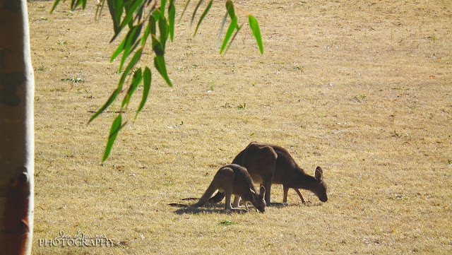 |
| Wallabies, kangaroos, emus, echidnas and bilbies abound right in the heart of Halls Gap itself |
Or if culture is your thing, try the
Brambuck Cultural Centre --
-- but be sure to set aside a whole day for this. If you try to stroll through in an hour, you'll miss so much. We just didn't have the time to do this properly, so ... next time.
Or, if the more recent history of the area is on your mind, a lot of info is given
in situ, on the info boards at the various lookouts. Such as this, at Mount William:
Admittedly, we ran through the Grampians. We had three days, all up, including the drive out and back. So we did ... one fancy restaurant, one cafe, one waterfall, two lakes, four or five lookouts, one camp ground, two dawns, and an enormous amount of driving.
We covered 1,500kms in all, and I can honestly say, we saw
Gariwerd from the road...
 |
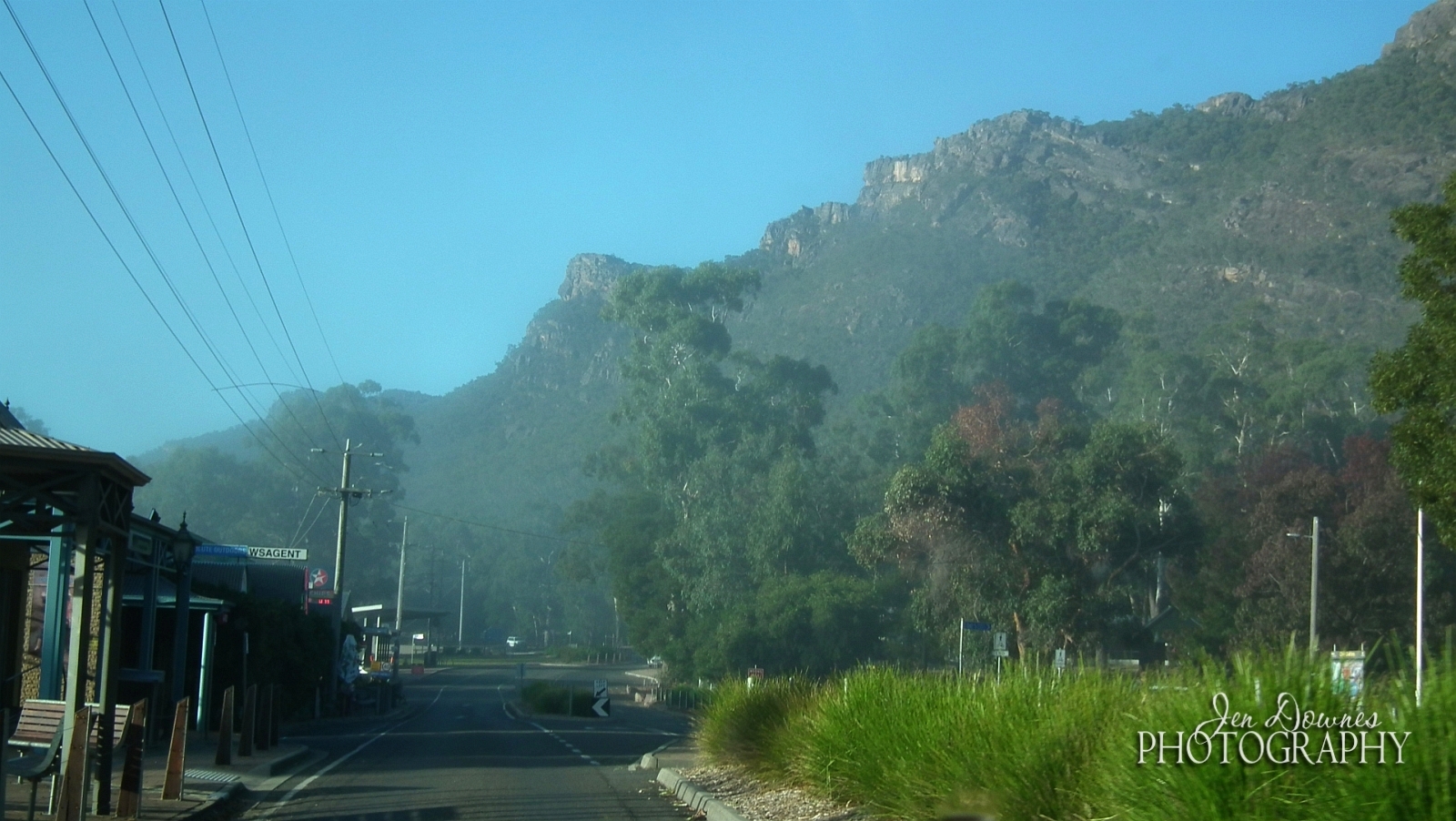
| Stand in the street in Halls Gap and look up. This is how you'll see the Grampians! |
 |
| A roadside shot, in Victoria Valley |
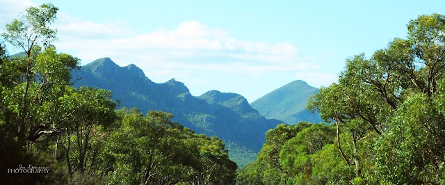 |
| Amazing landscapes, every time you turn around another bend in the road |
Full marks to the Victorian government for the road system that threads through and around the Grampians. The roads are in fantastic repair, and they're very well signed. The only thing South Aussies may find somewhat perplexing is that many of the roads are marked up as "driving hazards," or "dangerous conditions," and so forth. In fact, by comparison with our Adelaide Hills (Norton Summit, anyone?!) the Grampians are an easy,
easy drive. They're not dangerous at all at this time of year. I do wonder what it'd be like to drive them in winter. It does snow there. Mount William is tall enough ... this, from the
Halls Gap Lakeside webpage:
Having spent my childhood in Holland I never realized how many Australians have never experienced snow! This might be your chance, without spending an absolute fortune visiting the snow fields! Although snowfall in the valley itself is rare, Mt William (the highest point in the Grampians at 1167 meters) gets covered in snow nearly every winter, it’s great for making a snowman. The Grampians turns into a winter wonderland, beyond beauty!
Oh, yes, I'm tempted. Very tempted. We went there (for the first time!) and the end of the first month of autumn, or fall, if you prefer, and it was already very chilly in the mornings, though you were glad to get out of the sweaters and scarves by ten o'clock...
 |
| Lake Bellfield, on the outskirts of Halls Gap |
 |
| A misty dawn, from Boroka Lookout |
 |
| Halls Gap is lost in the mist, 616m below... |
In other posts, I'll share the drive to get there and back, which is an adventure in itself! Mother Nature had one special gift in store: the most incredible sunset on the river at Tailem Bend. Soon!